Barcelona Maps
Barcelona Metro Map

As well as all the metro lines and stations, the metro plan includes the train lines and train stations (Renfe/Adif), the Catalan railway lines (FGC) and the trams within the city. It also includes the railway line and metro line (L9) to the airport.
You can download a PDF version from the Transports Metropolitans de Barcelona website here: Barcelona Metro Map (PDF download).
______
Barcelona Bus Map

Click the map image above to download a PDF of the bus map.
For all the bus routes in Barcelona it’s best to visit the TMB (Transports Metropolitans de Barcelona) website. There you can choose individual bus routes and then view a map of each route: bus and metro individual maps.
The TMB app
The TMB app includes all the bus and metro routes combined with other services from Bicing, AMBici, Donkey Republic, Cooltra and Bolt. The app also allows you to top up your metro cards.
______
Barcelona’s Official City Map – Plànol BCN
Everyone uses Google Maps, but the Barcelona Council’s official online map is also excellent. You can add or remove things such as the metro stations, public administration buildings, accommodation, sports facilities and restaurants:
w33.bcn.cat/planolBCN/en/

______
Barcelona city maps – quick links (external)
Metro Map | Bus Map | City Map | Tourist Bus Map
______
Google Maps
For a detailed street map of Barcelona you can’t really beat Google maps. With satellite view, transport, terrain and traffic info, not to mention street view; for all these reasons Google Maps is included here.
______
Tourist Bus
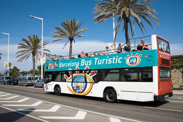
If you’re visiting Barcelona, one of the best ways to see the city is to take one of the tourist buses. Barcelona Bus Turistic has two routes – blue and red – and they give you a tour of the city in an open top bus. You can hop on and off at any of the bus stops (many of which are located at main tourist attractions) for the price of one ticket.
The tours run very regularly all year round, and there’s also an app you can download.
______
Transport Tickets
Finally, for information of ticket prices and the types of tickets available, check out our section on Barcelona Transport.